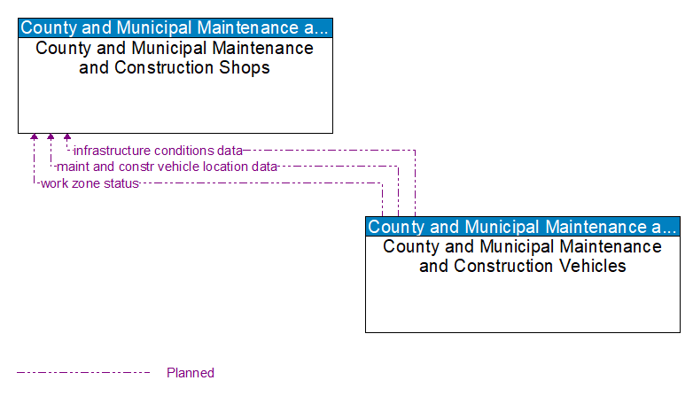
Interface: County and Municipal Maintenance and Construction Shops - County and Municipal Maintenance and Construction Vehicles

Architecture Flow Definitions
infrastructure conditions data (Planned) Applicable ITS Standards
Current condition of pavement, bridges, culverts, signs, and other roadway infrastructure as measured by on–board sensors or read from infrastructure–based sensors. The data may include raw data or images (e.g., photo logs) that indicate the current status of the infrastructure.
maint and constr vehicle location data (Planned) Applicable ITS Standards
The current location and related status (e.g., direction and speed) of the maintenance/construction vehicle.
work zone status (Planned) Applicable ITS Standards
Current work zone status including current location (and future locations for moving work zones), impact to the roadway, required lane shifts, expected time(s) and duration of impact, anticipated delays, alternate routes, and suggested speed limits.