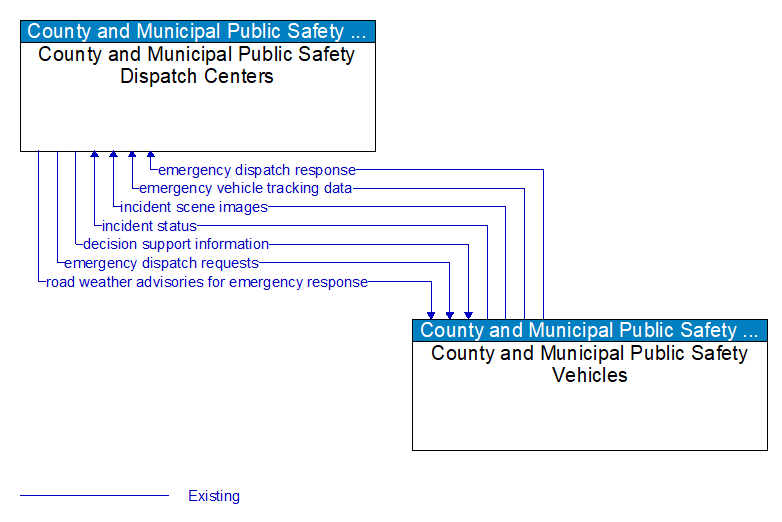
Interface: County and Municipal Public Safety Dispatch Centers - County and Municipal Public Safety Vehicles

Architecture Flow Definitions
decision support information (Existing) Applicable ITS Standards
Information provided to support effective and safe incident response, including local traffic, road, and weather conditions, hazardous material information, and the current status of resources (including vehicles, other equipment, supplies) that have been allocated to an incident.
emergency dispatch requests (Existing) Applicable ITS Standards
Emergency vehicle dispatch instructions including incident location and available information concerning the incident.
emergency dispatch response (Existing) Applicable ITS Standards
Request for additional emergency dispatch information and provision of en route status.
emergency vehicle tracking data (Existing) Applicable ITS Standards
The current location and operating status of the emergency vehicle.
incident scene images (Existing) Applicable ITS Standards
Real time images or video of an incident scene. This flow includes the images or video and meta data that describes the images.
incident status (Existing) Applicable ITS Standards
Information gathered at the incident site that more completely characterizes the incident and provides current incident response status. This includes notification of medical facility transport and details about the vehicle occupants being transported.
road weather advisories for emergency response (Existing) Applicable ITS Standards
Segment–specific weather and road conditions including real–time advisories of deteriorating road and weather conditions, medium–term advisories for the next 2�12 hours, and long–term advisories more than 12 hours into the future. This flow is filtered, tailored, and augmented to support emergency responders.