Bicycle and Pedestrian
Appropriate bicycle and pedestrian infrastructure is an integral part of a comprehensive transportation system. Providing for bicyclists and pedestrians contributes to a healthy community by reducing air pollution through reducing the number of vehicles on the road, as well as by increasing the individual health of those who walk or bike. Bicycle and pedestrian use also supports other transportation modes by reducing the number of cars on the road – thus reducing both congestion and maintenance needs – and providing for the “first and last mile” – that portion of a trip before and after a person uses public transportation or parks their private vehicle.
The Active Transportation Workgroup advises COMPASS on regional bicycle and pedestrian planning efforts, including providing feedback on infrastructure and level of service maps, bicycle/pedestrian demand, public transportation connectivity, and freight conflicts.
COMPASS’ bicycle and pedestrian counter and data bike programs support regional planning efforts by collecting data on pathway use and conditions.
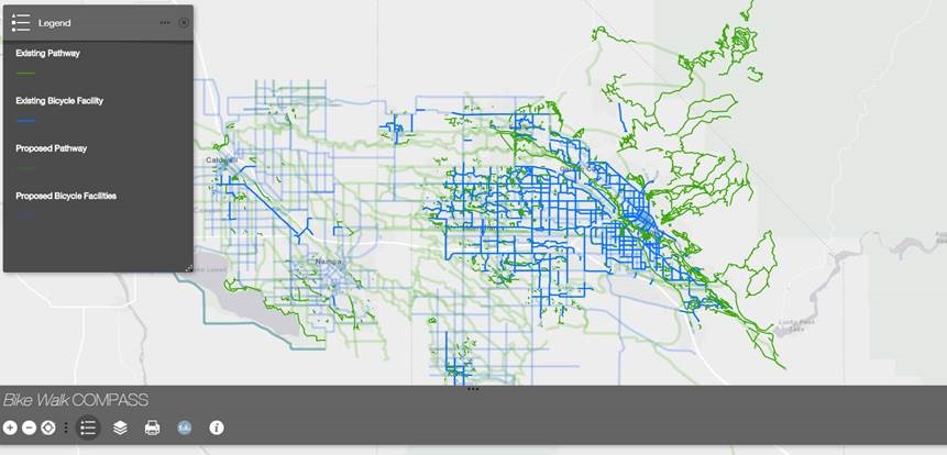
The Bike Walk Compass, an interactive bicycle and pedestrian infrastructure map application, was created by COMPASS to inform member agencies, elected officials, residents, and visitors about the existing and planned bicycle and pedestrian infrastructure within Ada and Canyon Counties.
COMPASS Bicycle and Pedestrian Studies and Plans
